


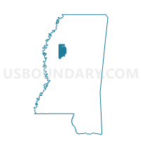
MVSU Voting District, Leflore County, Mississippi
About
Outline

Summary
| Unique Area Identifier | 606068 |
| Name | MVSU Voting District |
| County | Leflore County |
| State | Mississippi |
| Area (square miles) | 10.34 |
| Land Area (square miles) | 10.20 |
| Water Area (square miles) | 0.15 |
| % of Land Area | 98.58 |
| % of Water Area | 1.42 |
| Latitude of the Internal Point | 33.53175610 |
| Longtitude of the Internal Point | -90.35148610 |
Maps


Graphs
Select a template below for downloading or customizing gragh for MVSU Voting District, Leflore County, Mississippi


Neighbors
Neighoring Voting District (by Name) Neighboring Voting District on the Map
- North Itta Bena Voting District, Leflore County, MS
- Schlater Voting District, Leflore County, MS
- West Greenwood Voting District, Leflore County, MS